Mary River National Park
Appearance
| Mary River National Park Northern Territory | |
|---|---|
| Nearest town or city | Humpty Doo |
| Coordinates | 12°42′S 131°43′E / 12.700°S 131.717°E |
| Established | 20 May 1966[1] |
| Area | 1,215.25 km2 (469.2 sq mi)[1] |
| Visitation | 336,400 (in 2017)[2] |
| Managing authorities | Parks and Wildlife Commission of the Northern Territory |
| Website | Mary River National Park |
| See also | Protected areas of the Northern Territory |
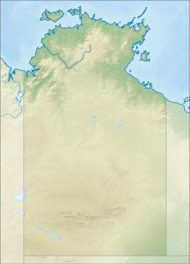
Mary River National Park is an Australian national park located about 100 kilometres (62 mi) east and stretching to the southeast of Darwin in the Northern Territory.
Wildlife
[edit]The national park is inhabited by several bird species and saltwater crocodiles.[3]
See also
[edit]References
[edit]- ^ a b c "CAPAD 2012 Northern Territory Summary (see 'DETAIL' tab)". CAPAD 2012. Australian Government - Department of the Environment. 7 February 2014. Retrieved 7 February 2014.
- ^ "Park visitor data". Department of Tourism Sport and Culture. Northern Territory Government. Retrieved 20 April 2019.
Traffic counter located along Shady Camp road.
- ^ Government, Northern Territory (19 December 2023). "Mary River National Park". nt.gov.au. Retrieved 21 April 2024.
External links
[edit]- Mary River National Park – Natural Resources, Environment, The Arts and Sport; Northern Territory Government. Accessed on 10 May 2012.
- [1] Parks and Wildlife Commission NT
- Official map of Mary River National Park

